**Update: it appears that access to this trail has been restricted for now. Please respect the closure. I will provide an update if or when the trail reopens.**
The Goat Mountain trail is an unknown Front Range gem. Thousands of weekend hikers walk right by its unmarked trailhead every weekend, entirely unaware. It is featured on All Trails, summitpost.org has a write up on it, and Colorado Mountain Club has lead group hikes. Yet it is not present on any map I’ve ever seen. The trail is highly accessible, offers a fair challenge even for experienced hikers, and provides a unique experience in the Denver foothills.
At the southwestern edge of the Denver urban sprawl, the South Platte River cuts a meandering passage through the Rocky Mountain foothills. Waterton Canyon, as this outdoor playground is called, is one of the most crowded and congested hikes in the Front Range. During summer weekend days, its substantial trailhead parking lot can fill up early in the morning, and traffic can snarl the surrounding neighborhood. Jefferson County and Douglas County seem perfectly content to ignore the situation. Perhaps because the trailhead is practically on the border between the two counties, they consider it the other’s problem. This is your heads up on the parking lot and traffic situation. But if you let the crowds and the traffic morass serve as a deterrent, you’ll miss out on one of the epic foothill hikes.
Goat Mountain tops out at 7785 feet, and its summit lies 2340 feet above the river. The standard east ridge route is about seven miles round trip. On my most recent outing, I completed the hike in about four hours, including time at the summit for snacks and photos. I understand there is another route up through Cottonwood Gulch from the west, but I have not found any information on this route and have not tried it myself. I suspect it may traverse private property but I can’t be sure. I will update this blog if I find any information on this mystery western route.
The Goat Mountain trail begins about a mile from the beginning of Waterton Canyon and is unquestionably the yin to Waterton’s yang. While the Waterton Canyon trail is a two-lane dirt road crowded with pedestrians (the only vehicular traffic is an occasional Denver Water department truck), the Goat Mountain trail is a faint scratch through the landscape where on a busy day you might run into another person.
Don’t let the first wide level mile of Waterton Canyon set your expectations of Goat Mountain and lull you into thinking it will be easy. This climb is not “easy” and so resides in a completely different category from other foothill hikes such as Mt. Falcon or Carpenter Peak. Do not underestimate Goat Mountain or it will humble you. If you instead expect a decent and unanticipated challenge uncharacteristic of a foothill, you will be fine and you will enjoy your day.
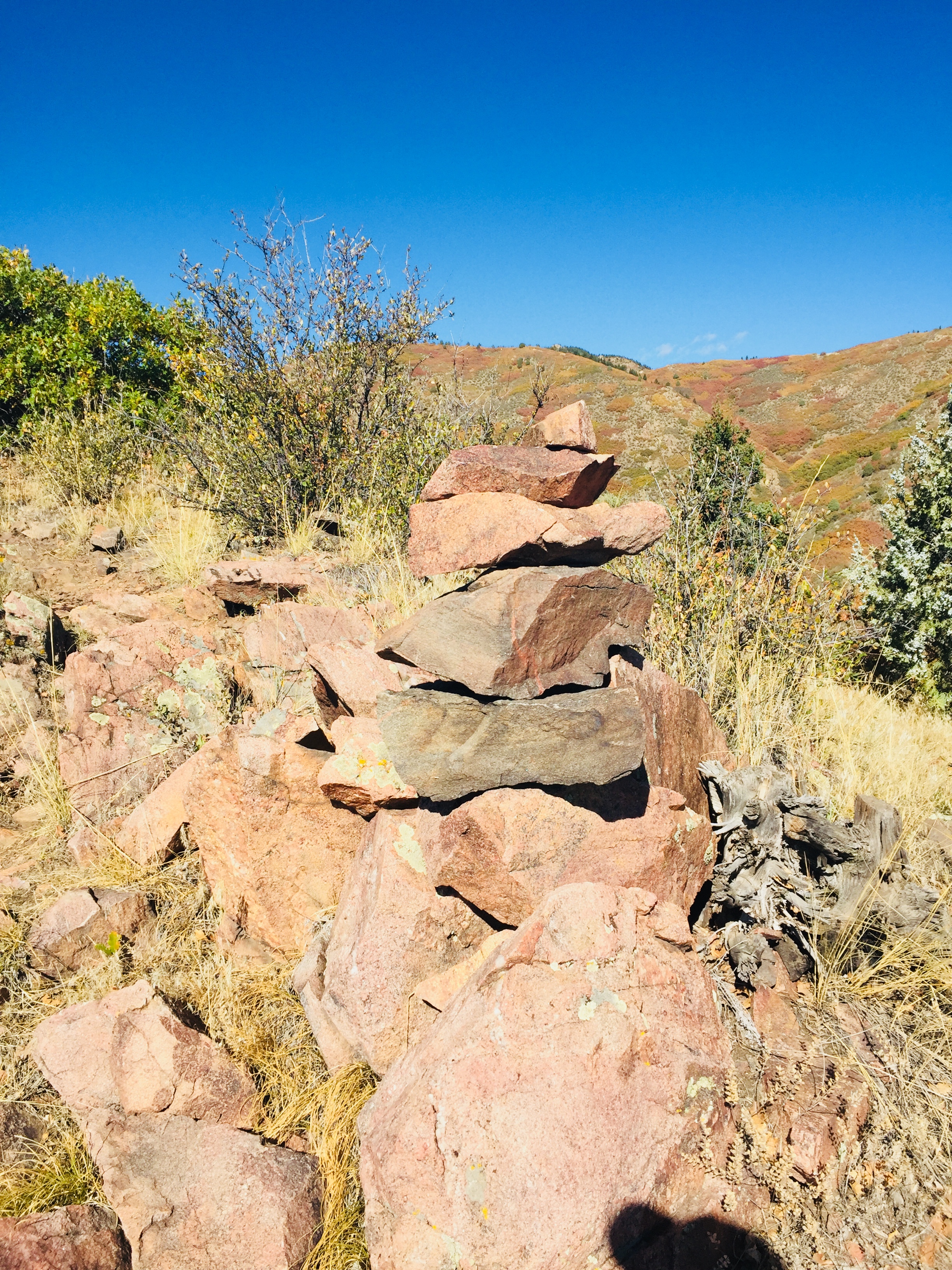
This is a social trail the entire way and can be overgrown in areas. To the best of my knowledge, it is not maintained, save for a certain hiking blogger who has been known to bring hedge trimming shears along with him. Ahem. The hike, from base to top, feels wild, natural, and undeveloped. It does begin rather wide and pronounced, but quickly and steadily deteriorates. You get the feeling most hikers give up after the first mile. At times, the trail becomes faint enough that you’re best guided by an occasional cairn, so keep a sharp eye for them.
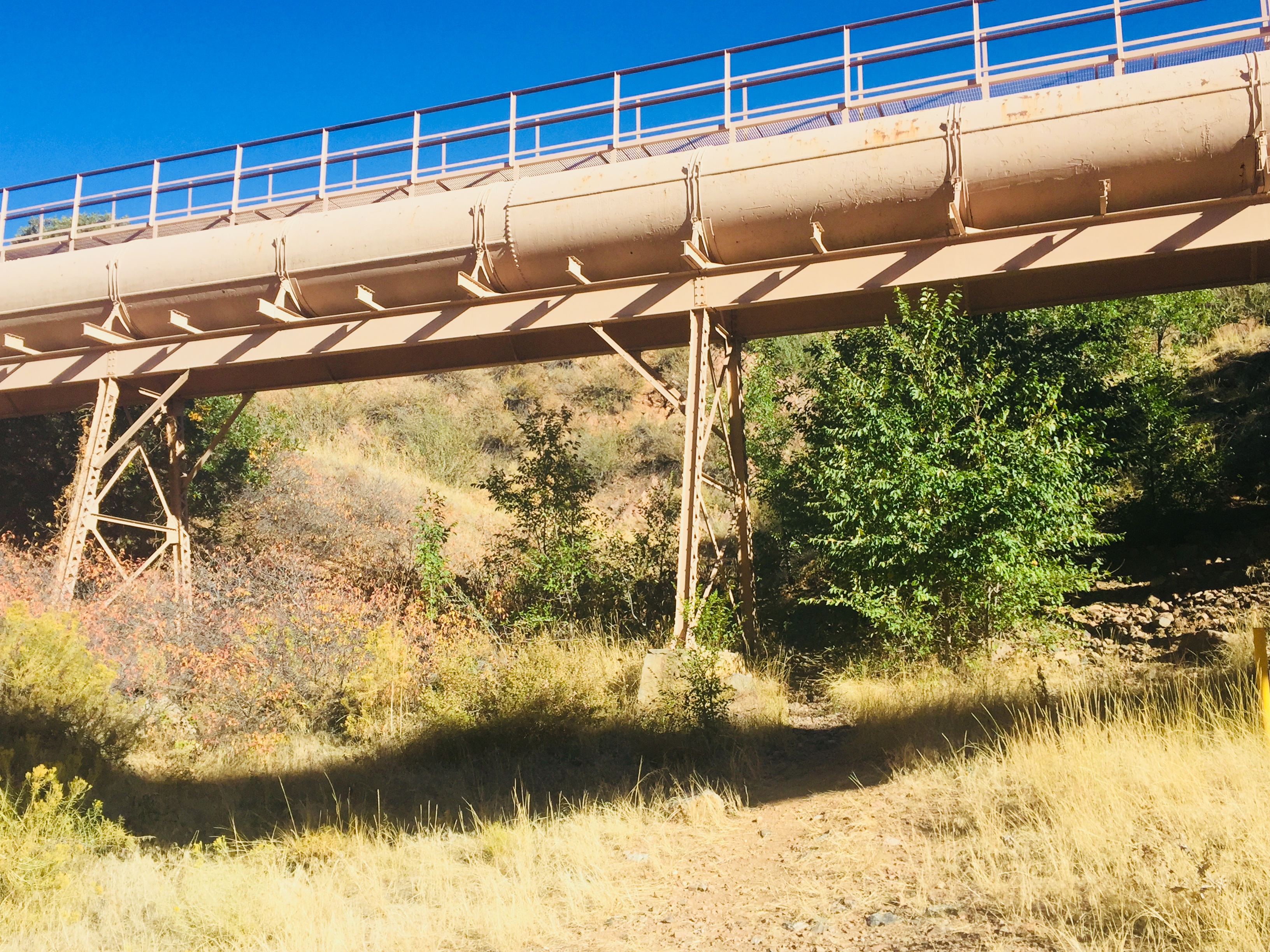
At almost precisely one mile from the Waterton Canyon trailhead, you will cross under a set of two large water pipelines suspended above the river and the road. These pipelines carry Platte River water to storage tanks and reservoirs throughout the western edge of the metro area, and also conveniently serve as the trail head marker for Goat Mountain. Under the pipeline furthest to the north, away from the river and road, between two small trees, Goat Mountain’s faint trail leads north toward the canyon wall. Hardly a hundred feet into the hike, the first challenge presents itself. As the trail begins its initial climb out of the canyon, it is steep and badly eroded. You will not find it a solid or stable path, and you will need to exercise a healthy dose of care to ynot lose your footing. After about a quarter mile, the trail levels out but comes uncomfortably close to the Lockheed Martin Space facility. I suspect that lost hikers who venture too far off trail may be greeted by grumpy men with guns. At this point, you’re on the east ridge of Goat Mountain, and the trail takes an abrupt westerly turn to follow the ridge all the way to the summit.
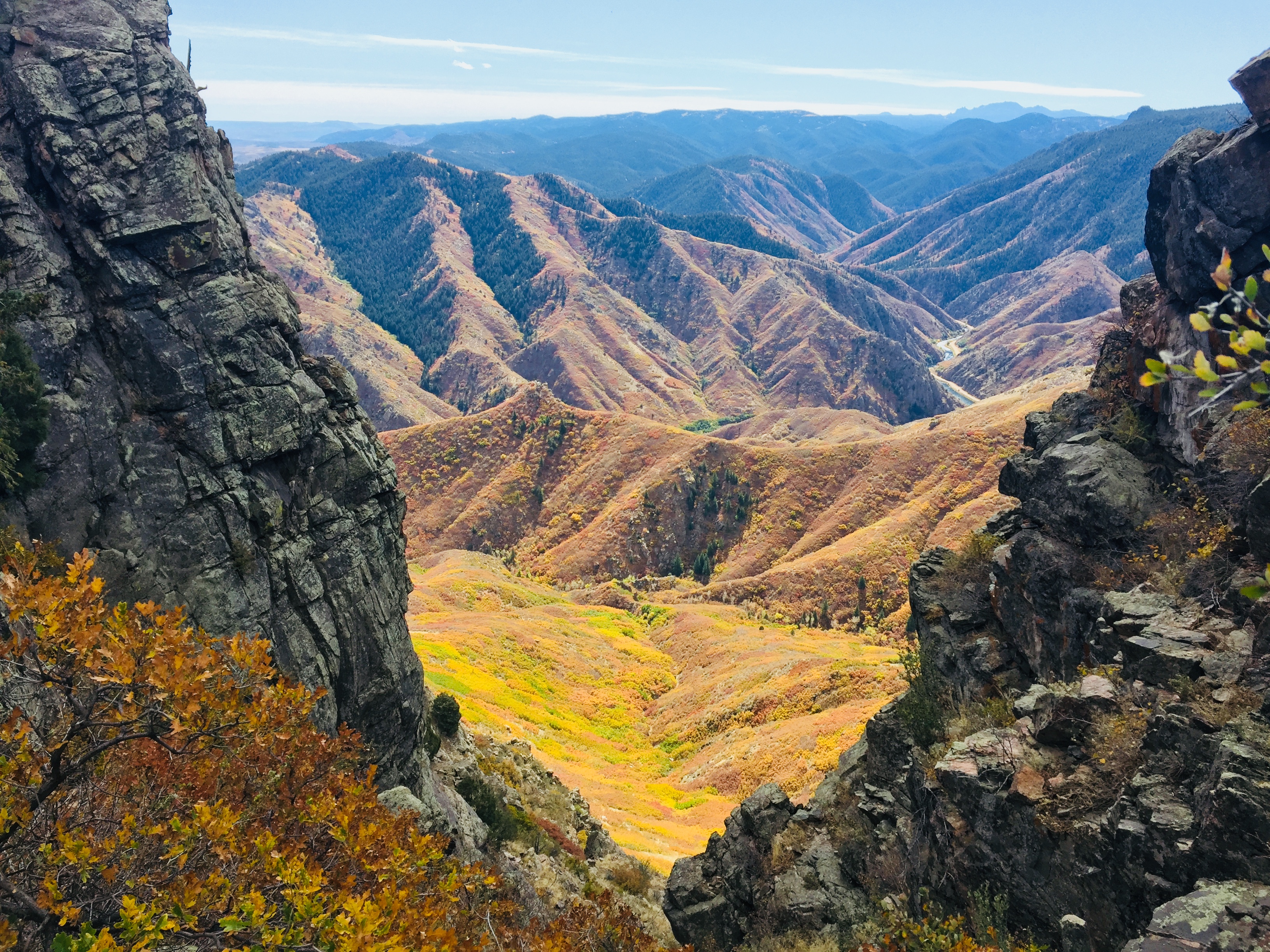
The ridge is an interesting study of ecosystems. Its south facing side is sun bleached, dry, sandy, and blanketed with scrub brush. The north facing side is shady, cool, green, and peppered with pine trees. Whenever the trail shifts from one side to the other, you step into an entirely different world. This aspect helps counter the frustration imposed by Goat’s schizophrenic steepness. The ridge is constantly undulating, and its four (at least) false summits can be disheartening.
On your way up the ridge, you will face a handful of class 2 stretches, including one that could probably be made class 3 if you’re creative and wanting a challenge. I haven’t (yet) tried this climb in snow but I do think it could make a great training hike for high altitude snow routes. The challenge would lend itself to building mountaineering skills in a safer environment than what you’d encounter on a big mountain.
After three and a half miles and over 2000 feet of elevation gain, you are rewarded at the top with an excellent vantage point of the Denver metro area. Goat Mountain reminds us that you don’t always have to go far to find a great adventure. It can sometimes be in your back yard.
Check out the YouTube video of my hike here: https://youtu.be/hkmCDfDZV1U

looks like this one has been closed down now! There is a sign at the cutoff from the waterton canyon trail. Just fyi for anyone wanting to do this
LikeLiked by 1 person
Thank you for the heads up, Tyler. I stopped by the other day and confirmed that it is indeed closed. The sign says “No Trespassing. Not a public hiking trail.” This is a real bummer.
LikeLike