Colorado has 58 named 14ers and over 600 13ers. In a state with this kind of pedigree, it’s no wonder Chief Mountain is relatively obscure and unknown. At only 11,709 feet, Chief is a runt among titans. But don’t let its small stature fool you—Chief delivers 14er views without requiring 14er effort. Those who dismiss or overlook Chief are missing out on one of Colorado’s truly great summit hikes.
To get to the trailhead, start in Evergreen at the intersection of CO hwy 103 (Squaw Pass Road) and CO hwy 74 (Evergreen Pkwy). Proceed west on Squaw Pass Road about 12.5 miles. There is a long paved pull out on the north (right) side of the road. Parallel park here. You’ll be directly above the ski lift at Echo Mountain ski area.
The trail begins directly across the highway from the parking area. The first few hundred feet are the steepest and require careful steps through numerous tree roots. But the rest of the easy trail, 1.75 miles and 1129 vertical feet to the summit, is mostly smooth and in great condition.

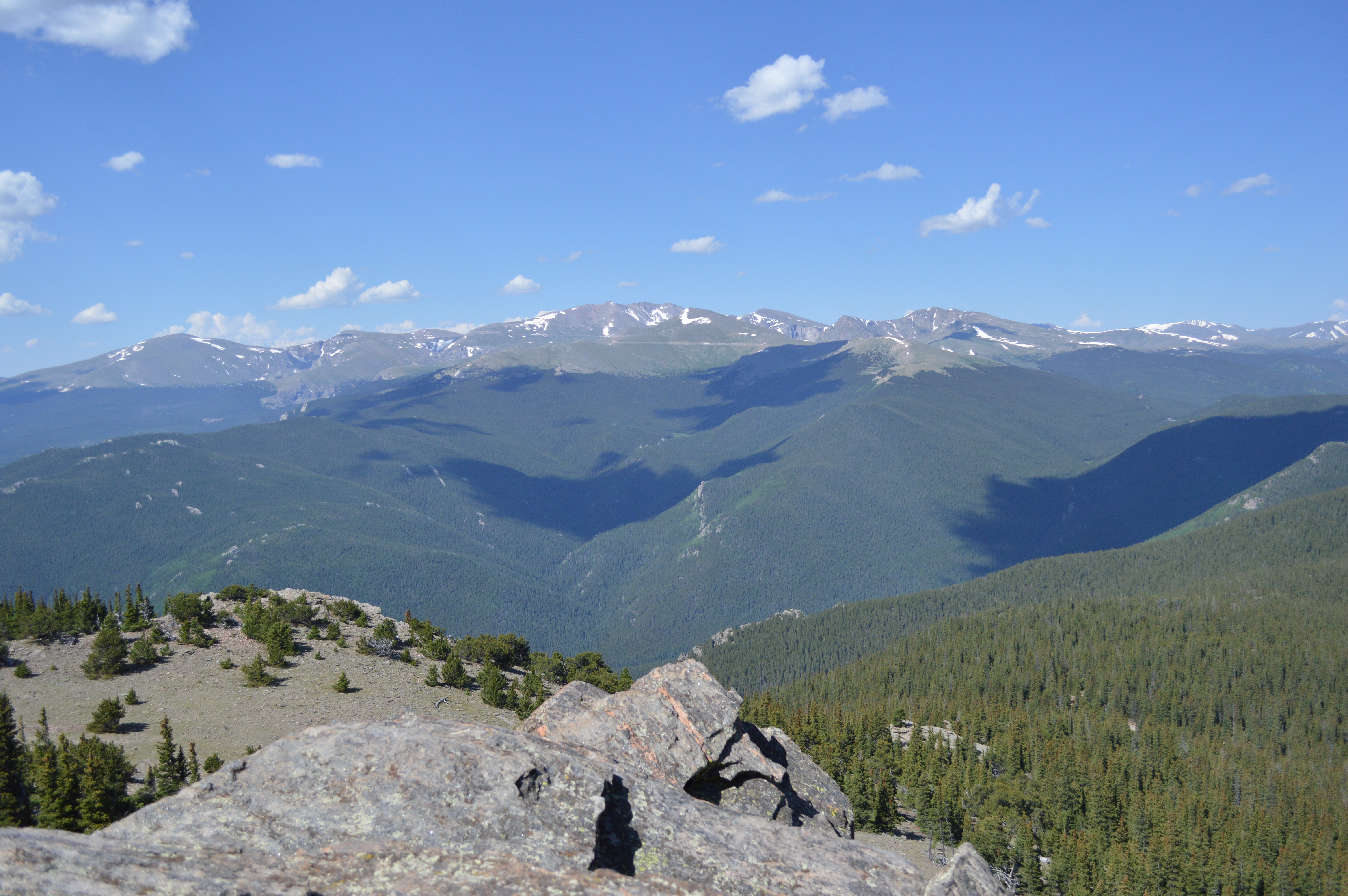
The trail runs to the southeast and after about a half mile from the trailhead crosses the old squaw pass road, now a good snowshoeing and cross country skiing trail. Another half mile of easy hiking will bring you to the saddle between Chief and Papoose Mountain. The trail then turns due south before it switchbacks to the northwest and continues to climb through trees as it curves around Chief to the west. Three more switchbacks bring you above timberline, then you’ll turn east across tundra. One more turn to the south brings you to the rocky summit. There’s a short and mild class 2 scramble at the top that you’ll hardly notice from being mesmerized by the 360 degree views of the surrounding area.
Just a few miles to the west, Mt. Evans scrapes the sky at over 14,000 feet, as do the twins Grays and Torreys in the distance. Pikes Peak is visible to the south, and in the distance to the north, Longs’ flat summit beckons adventurous climbers. To the east, the Denver metro and the plains sprawl out like a mat as far as you can see.
I hesitated to use the word “easy” in my trail description above. Though this trail is “easy” in comparison to the standards of Colorado summit hikes, I should remind our out of state visitors and those not used to climbing mountains that this is not a typical walk in the park. You will be at an elevation where many experience altitude sickness. Do not make this hike your first activity after landing at DIA. Acclimate yourself, drink plenty of water, and take your time up the trail.
Check out my YouTube video of this hike: https://youtu.be/X-n-3c90xXw
Check out my field notes for this hike: https://stevegrimeswriter.com/2021/07/31/field-notes-chief-mountain/
